Ayodhya Hills (Ajodhya Pahar) from Ranchi - 114 km, 3 hr - 3 hr 30 min by cab
Purulia's plateau of dams, waterfalls and palash, over the Bengal border
Ayodhya Hills (Ajodhya Pahar) is 114 km from Ranchi, about 3 hr - 3 hr 30 min by cab. Purulia's plateau of dams, waterfalls and palash, over the Bengal border. The best time to visit is Oct - Mar (palash: Feb - Mar).
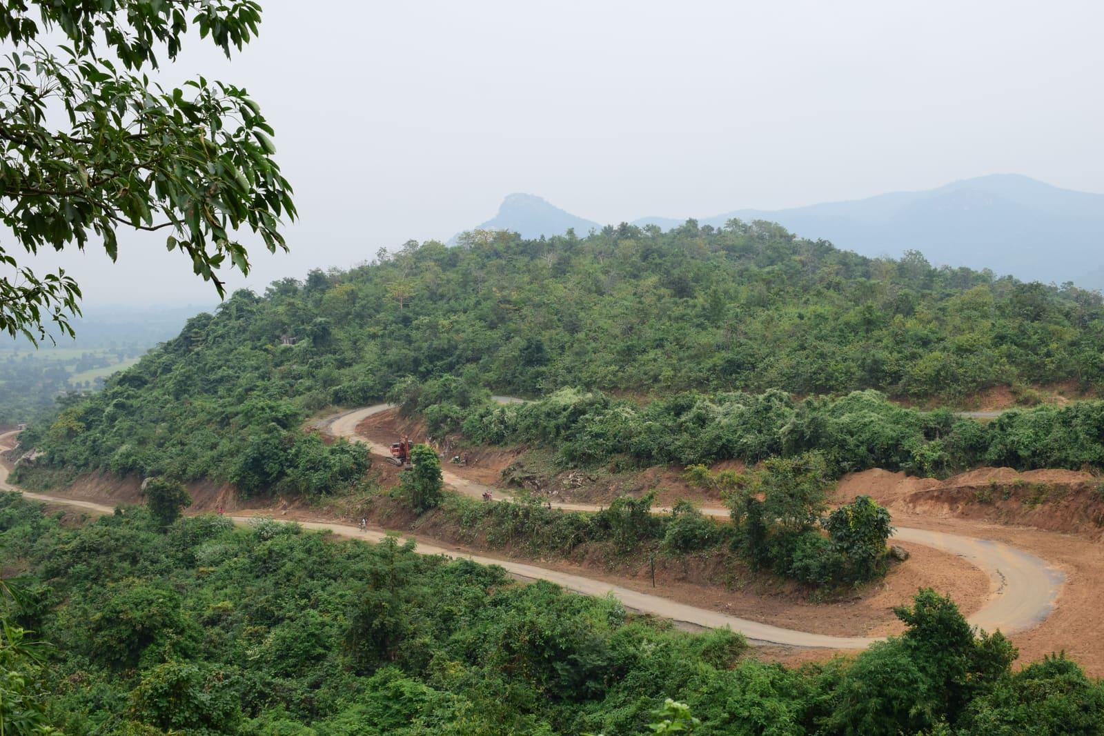
Ayodhya Hills - Ajodhya Pahar in Bengali - is a plateau of about 400 sq km in Baghmundi block of Purulia district, West Bengal, on the eastern edge of the Chota Nagpur plateau, and has nothing to do with Ayodhya in Uttar Pradesh. The hill-top bazaar sits at about 575 m and is 114 km from Ranchi Junction by road, closer to Ranchi than Purulia town is. Almost everything worth seeing is within 3-18 km of the top: Mayur Pahar for sunset, the two reservoirs of the Purulia Pumped Storage Project, Marble Lake, Bamni and Turga Falls, Murguma Dam and Charida, the village that carves Purulia's Chhau masks. It is at its best from October to March, and turns red with palash around Holi.
How to reach Ayodhya Hills (Ajodhya Pahar) from Ranchi
The direct road from Ranchi leaves through Namkum and Angara on the Ranchi-Purulia road to Silli and Muri, crosses the Subarnarekha into West Bengal at Tulin about 63 km out, then runs through Ilu, Koreng and Baghmundi and climbs a 15 km ghat past Turga Falls to the hill top - 114 km from Ranchi Junction and 116 km from Albert Ekka Chowk, about 3 to 3.5 hours by cab. The road via Jhalda, Begunkodar and the Sirkabad ghat is almost as short at 117 km. Purulia town is not on the way: going through it makes the trip 161 km. Visitors need no permit; a Jharkhand taxi crossing into West Bengal needs an All India Tourist Permit, which Raahi Saarthi cabs carry, with the cost inside the fare. The nearest railway stations are Purulia Junction and Balarampur, each about 42 km from the top.
Highlights
- Mayur Pahar (598 m) - the sunset viewpoint, 2.6 km from the hill top
- Upper and Lower Dams of the 900 MW Purulia Pumped Storage Project
- Marble Lake - a flooded quarry with banded granite-gneiss walls
- Bamni and Turga Falls, fullest from July to September
- Charida - the village that makes Purulia's GI-tagged Chhau masks
- Chemtaburu (about 700 m) - the range's true highest peak, not the often-quoted Gorgaburu
Insider tips
- Do not route via Purulia town - it turns a 114 km drive into 161 km
- Stay a night if you want Mayur Pahar at sunset; otherwise it means 3.5 hours of ghat and village road back to Ranchi in the dark
- Government rooms on the hill top (Niharika, Malabika, Bibhabari) are booked at prdtourism.wb.gov.in, ₹400-1,800 a night
- April to June is hard going - Purulia town averages 37.9°C in May
- Mobile signal is weak around Murguma; download offline maps before you leave
- Turga Dam and Falls sit beside the works for the new Turga Pumped Storage Project - check access locally
Suggested itinerary
- 106:00 - Pickup from Ranchi; Namkum, Silli, Muri, into West Bengal at Tulin
- 209:00 - Charida mask village, near Baghmundi
- 310:00 - Turga Falls and Bamni Falls on the way up the ghat
- 411:30 - Marble Lake and the Upper Dam
- 513:00 - Lunch at the hill top; Mayur Pahar and Sita Kund
- 615:30 - Leave via Murguma Dam; back in Ranchi around 19:30-20:00 (about 228 km in all)
- 7Two days instead: sunset at Mayur Pahar and a night on the hill top, then the dams, falls and Charida on day 2 (about 242 km in all)
- Distance from Ranchi
- 114 km
- Drive time
- 3 hr - 3 hr 30 min
- Best time to visit
- Oct - Mar (palash: Feb - Mar)
- Type
- Hill Station
- State
- West Bengal
- District
- Purulia
Distance to Ayodhya Hills from other places
| From | Distance | Drive time |
|---|---|---|
| Ranchi Junction railway stationvia Namkum, Silli, Muri, Tulin, Baghmundi | 114 km | 3 hr - 3 hr 30 min |
| Albert Ekka Chowkvia Namkum, Silli, Muri, Tulin, Baghmundi | 116 km | 3 hr - 3 hr 30 min |
| Hundru Fallsvia Silli, Muri, Tulin, Baghmundi | 87 km | 2 hr 30 min |
| Purulia townvia Sirkabad ghat | 42 km | 1 hr - 1 hr 15 min |
| Balarampur stationvia Matha | 42 km | - |
| Jamshedpurvia Chandil, Nimdih, Balarampur, Baghmundi | 101 km | 2 hr 30 min - 3 hr |
| Bokaro Steel City | 81 km | 2 hr - 2 hr 30 min |
Road distance, not straight line. Distances are measured over the OpenStreetMap road network unless marked otherwise; drive times are what a cab takes in ordinary traffic. The same figures are in /distances.json.
Nearby attractions
- Sita Kund (1.6 km)
- Mayur Pahar (2.6 km)
- Upper Dam and Marble Lake (7.6 km)
- Bamni Falls (8.7 km)
- Turga Falls (10.6 km)
- Murguma Dam (18 km)
- Charida mask village (18 km)
- Pakhi Pahar (26 km)
FAQs about Ayodhya Hills (Ajodhya Pahar)
How far is Ayodhya Hills from Ranchi?
Ayodhya Hills (Ajodhya Pahar) in Purulia district, West Bengal, is 114 km from Ranchi Junction and 116 km from Albert Ekka Chowk by road, about 3 to 3.5 hours by cab via Silli, Muri, Tulin and Baghmundi. This is the Purulia hill range, not Ayodhya in Uttar Pradesh, which is roughly 500-670 km from Ranchi.
Is Purulia town on the way from Ranchi to Ayodhya Hills?
No. The Ayodhya Hills top is 114 km from Ranchi and Purulia town about 124 km, so the hills are the nearer of the two, and driving through Purulia town makes the trip 161 km. The direct road crosses into West Bengal at Tulin and climbs from Baghmundi. From Purulia town itself the hill top is 40-42 km via the Sirkabad ghat.
Can Ayodhya Hills be done as a day trip from Ranchi?
Yes, as a long day of 13-14 hours and about 228 km: leave Ranchi at 06:00, see Charida, Turga and Bamni Falls, Marble Lake and the Upper Dam, lunch on the hill top, and leave by about 15:30 to be back around 19:30-20:00. The day trip means missing sunset at Mayur Pahar; for that, stay a night on the hill and make it two days.
What is the best time to visit Ayodhya Hills?
October to March. The palash (flame of the forest) turns the Ayodhya Hills red around Holi, usually late February to March, and the waterfalls are fullest in the July-September monsoon, when Purulia gets most of its 1,437 mm of annual rain. April to June is hot: Purulia town averages 37.9°C in May, and the hill top is only about 2°C cooler.
Where to stay in Ayodhya Hills?
The government guest houses on the Ayodhya Hills top - Niharika, Malabika and Bibhabari - are run by WBCADC under West Bengal's Panchayat and Rural Development department and cost ₹400 to ₹1,800 a night, booked at prdtourism.wb.gov.in. WBTDCL's cottages at Murguma Dam, 18 km away, run about ₹2,200-5,400, and private resorts around the hills list from about ₹1,000 to ₹7,000.
Do I need a permit to visit Ayodhya Hills from Jharkhand?
Visitors need no permit to visit Ayodhya Hills. The taxi does: a Jharkhand-registered cab carrying tourists into West Bengal needs an All India Tourist Permit or a West Bengal temporary permit. Raahi Saarthi's cabs run on an All India Tourist Permit and its cost is inside the fare, so nothing is paid at the border.
How far is Ayodhya Hills from Hundru Falls, Jamshedpur and Bokaro?
By road the Ayodhya Hills top is 87 km from Hundru Falls - a Ranchi-Hundru-Ayodhya day adds only about 17 km to the direct drive - about 101 km from Jamshedpur via Chandil and Balarampur, and 81-84 km from Bokaro.
Is Ayodhya Hills safe to visit?
Yes, for ordinary tourism. Baghmundi block was once affected by Maoist activity, but Purulia is no longer on the Union Home Ministry's list of Left Wing Extremism-affected districts. The practical cautions are the roads - avoid the ghat roads after dark - and weak mobile signal in places such as Murguma.
Nearby places to visit
Fares and details last reviewed:
Book a cab to Ayodhya Hills (Ajodhya Pahar)
Fixed fare, no advance payment, pay after the ride.